Kollam Location
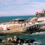
Kollam the fourth largest city of Kerala is a coastal city located in banks of the Ashtamudi Kerala. It is about 74 km from the capital city of the state Thiruvananthapuram. It is bordered by the Arabian Sea in the west and is connected to other cities of Kerala by National Higways NH 47, NH 220, NH 744.
Kollam on Google Map
How to Reach Kollam
By Air– Trivandrum International Airport located about 71 km from Kollam is the nearest airport to the city. The airport have regular flights from all the major cities of India. From there Kollam can be easily accessed by road or by railways.
By Train– Kollam has one of the largest Railway Station of Kerala and is well connects by the railway network of India and the state Kerala. Tourist from south can easily reach the city as their are direct train facility. But from north there are no direct train to the city.
By Road– Kollam can be easily accessed by the roads it is connected by the national highways NH-47, NH-220, and NH-208. In Kerala there various bus services to the city run by government and private bus operators.
Kollam Distance Chart
| City | Location |
|---|---|
| Madurai | 259 Km |
| Thiruvananthapuram | 69 Km |
| Kottayam | 96 Km |
| Chennai | 715 Km |
| Cochin | 136 km |
| Kozhikode | 329 Km |
| Coimbatore | 319 Km |
| Ooty | 492 Km |
| Bangalore | 661 Km |
| Mangalore | 564 Km |


Add How to Reach Kollam Feedback, Comments, Reviews