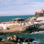
Neyyattinkara lies 18 km to the south of Thiruvananthapuram city on the National Highway 47 to Kanyakumari. The rapidly growing Thiruvananthapuram city has almost reached its outskirts. The town is mostly residential, with lots of service sector establishments. It’s also the headquarters of Neyyattinkara Taluk.
Neyyattinkara on Google Map
How to Reach Neyyattinkara
By Road– Neyyattinkara Bus Depot . KSRTC buses run from here at regular interval , the town is well connected to Trivandrum City .
Neyyattinkara Railway Station– The town of Neyyattinkara is well connected to the capital city of Thiruvananthapuram, 20 km away, through regular bus services operated by Kerala State Road Transport Corporation. Neyyattinkara KSRTC Bus Depot is the largest in the taluk and operates a wide array of services. These also include long-distance services to Guruvayoor, Thrissur, Kozhikkode, Chakkulath Kaavu, Ernakulam, Kanniyakumari, etc. A/C Low Floor buses frequently ply along the Neyyattinkara-East Fort-Medical College-Kazhakkuttam route.
By Air– The nearest airport is Thiruvananthapuram International Airport (25 km).
By Rail – Neyyattinkara Railway Station is located on the Mangalore- Trivandrum – Kanyakumari Railway line. Most of the express trains and all the passenger trains on this route stops at the station. The town is hence connected throughout major cities in India, including Chennai, Bangalore, Mumbai, Kolkata, Mangalore, Pune, etc.The Thiruvananthapuram Central Station is about (20 km) from the town.
Neyyattinkara Distance Chart
| City | Distance |
| Trivandrum | 19 Km |
| Kovalam | 17 Km |
| Kollam | 87 Km |
| Kottayam | 172 Km |
| Alleppey | 171 Km |
| Cochin | 224 Km |
| Nagercoil | 50 Km |
| Pathanmthitta | 128 Km |
| Tirunelveli | 134 Km |
| Thekkady | 225 Km |
| Madurai | 294 Km |


Add How To Reach Neyyattinkara Feedback, Comments, Reviews